
Uso de OpenET para un seguimiento preciso de las aguas subterráneas
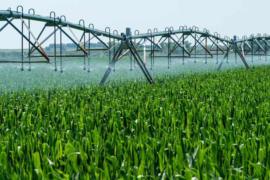
La sequía sigue siendo una preocupación crítica para el riego agrícola. Tradicionalmente, el uso de las aguas subterráneas se ha medido mediante caudalímetros, pero éstos no están ampliamente disponibles. Investigadores del Desert Research Institute (DRI) estudiaron el potencial de OpenET, una plataforma basada en satélites que calcula la evapotranspiración, para colmar esta laguna.
A estudiar publicado en Gestión del agua en la agricultura comparó los datos de OpenET con las lecturas de contadores de campos agrícolas de Nevada y Oregón. Los resultados indican que OpenET puede proporcionar estimaciones precisas del uso de aguas subterráneas en campos concretos. Es la primera vez que se utilizan datos de satélite para seguir la trayectoria del agua desde un pozo hasta un cultivo concreto, lo que ofrece nuevas perspectivas sobre la eficiencia del riego. El método es prometedor para la elaboración de planes de gestión de las aguas subterráneas en todo el país.
Thomas Ott, investigador científico adjunto del DRI y autor principal del estudio, destacó la importancia de este planteamiento, señalando que los estudios anteriores se centraban en regiones más amplias debido al acceso limitado a datos detallados de los contadores. OpenET, que utiliza datos de satélite de la NASA y el Servicio Geológico de EE.UU., ofrece una imagen más precisa del uso del agua al incorporar factores como la temperatura del aire y la radiación solar.
El estudio examinó dos regiones agrícolas: Diamond Valley (Nevada) y Harney Basin (Oregón), ambas muy dependientes de las aguas subterráneas para cultivos como la alfalfa y el heno. En Diamond Valley, las estimaciones de OpenET coincidieron en 7% con los datos medidos, mientras que en Harney Basin la diferencia fue de 17%. Los investigadores evaluaron el rendimiento de OpenET en diferentes sistemas de riego, revelando que OpenET puede ofrecer estimaciones más realistas del uso del agua en comparación con los métodos tradicionales.
El estudio también reveló que el uso real de agua en Diamond Valley era inferior al supuesto, con 90% de agua de riego utilizada por los cultivos, frente a 83% en Harney Basin. El equipo del DRI tiene previsto ampliar esta investigación en el marco de la Iniciativa del Agua de Nevada, una colaboración con la División de Recursos Hídricos de Nevada, el USGS y las partes interesadas del sector agrario local. Este proyecto pretende mejorar la gestión del agua en Nevada, el estado más seco de EE.UU., actualizando las estimaciones de disponibilidad y uso del agua realizadas hace décadas.
Ott destacó la importancia de la participación de las partes interesadas en la investigación, en particular con los agricultores, cuya cooperación es esencial para futuros estudios.
Respuestas